Peloponnese by Bike
In the shadow of covid-19
JANUARY 15, 2021 | PELOPONNESE | 19 MIN
JANUARY 15, 2021 | PELOPONNESE | 19 MIN
Peloponnese by Bike
In the shadow of covid-19

Karathona Beach, Nafplio, Peloponnese

Five weeks of cycling. 1,435 km and over 17,000 meters of elevation. In a sports or tourist sense, it’s not a feat; however, it was not about records, but about being on the road and enjoying the other world. This trip was not supposed to happen at all. A habit borrowed from northern countries … By bike in November, with a small tent? After all, my sleeping bag is too thin, it will be cold and it may even rain … Maybe it's better to wait until spring? But I’m in Greece, and the Peloponnese usually has a few degrees more than Mount Olympus.
My short-term dilemmas were solved by covid number 19 at the very beginning of November, spreading faster in northern Greece than in the south. The whole country was divided into two zones: even taverns were closed in the north, but they were to be kept open in the south. It was too much, I got on my bike and went.
My destination was the Peloponnese. More precisely, going around the entire peninsula. The magic of such a route was somewhat significant, but nevertheless important were … higher temperatures expected on the coast and the location of the running competition, the routes of which I wanted to check. It was supposed to be a bicycle trip, with short breaks for jogging. It was also supposed to be an expedition against covid. Due to the pandemic, none of these competitions took place in 2020.
riding on the edge
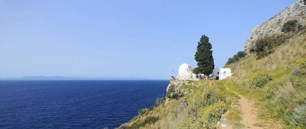
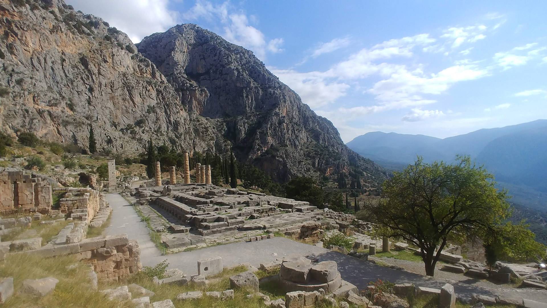
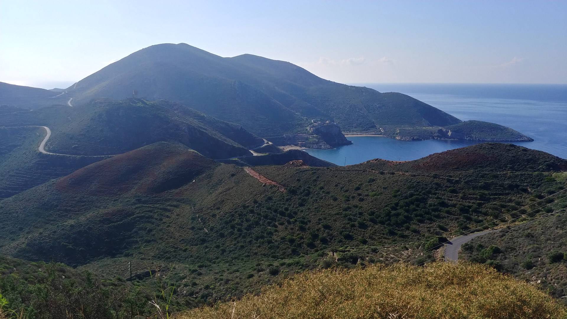
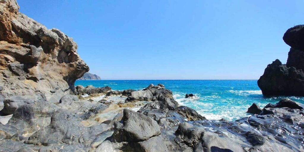
I took off from Livadia – a small town on the train line from Thessaloniki to Athens, far ahead of the Peloponnese. I wanted to see Delphi again – a huge, wonderfully situated ancient sanctuary on the slopes of Mount Parnassus. But I also wanted to slowly wean myself from the mainland Greece that I know and prepare myself to meet the splendor of the South. For almost 100 km, I go along the Gulf of Corinth, as if on the edge of the continent, on a narrow, winding road cut into the mountainsides, with the Peloponnese on the other side. From this perspective, it did look mysterious – a cloud-covered, mighty nest of mountains emerging straight from the sea. Does anyone live there? Are there roads and is it possible to travel there? The configuration of my route in this initial section turned out to be a good preview of what happened next. In fact, I was driving on the edge of the land all the time. The Aegean Sea was always on the right – sometimes at my fingertips, sometimes visible a bit in the distance, and the mountains jutting straight out of the sea to the left. I wondered with admiration about the builders of this road – how did they manage to carve space for two lanes in an almost vertical rock?
The Venetian fortress of Methoni and the island of Sapienza. Between them, several dozen kilometers beyond the horizon, the deepest place in the Mediterranean Sea - Calypso Deep. Southwestern Peloponnese.
Peloponnese in November
end of the world
Somewhere near the Methoni Peninsula, on the southwestern tip of the Peloponnese, I was hit by a total lockdown of Greece. The government here is about as efficient and predictable in the pandemic management as the Polish government. As soon as some rules come into force, they are already being changed and others implemented. A complete lockdown meant that shops and taverns, and generally almost everything else that was still open, was supposed to be closed. No one could move around without good reason. The latter, however, did not apply to tourists … it looks as if they had been forgotten. Maybe it is hardly surprising, since during my whole trip I did not meet a single (!) cyclist with panniers. And even if I wanted to comply with the new regulations and return home in Litochoro, I would have to get to the nearest train station first, which was several hundred kilometers away. So I kept going!

November, also in Greece, is completely “off-season”. Traffic on the roads was minimal, seaside towns were deserted, most hotels and taverns were closed. However, what happened after the lockdown was announced is beyond imagination. I have never touch such an experience of loneliness and emptiness before.
Kardamili – a village in Mani
On the map, the Peloponnese is shaped like a mulberry leaf, hence its historical name – Morea. This leaf sends four smaller peninsulas to the south, the middle one, which protrudes towards Africa, is called Mani, and Kardamili is one of its most important places. Mani is once a land of pirates and all rebels. Extremely mountainous, even for the Peloponnese, with the Tajget massif (2407) running through the center and villages usually located off the coast. Traditional gray stone and gray tile architecture and characteristic “residential towers” – all very picturesque, a real pearl in the crown of the Peloponnese.
Kardamili is located on the northwestern tip of Mani, in a small basin open to the sea on one side and cut off from the main Tajget massif by low but vertical rocks on the other. From many places in the village you can see Profitis Ilias – the highest peak of the Peloponnese, covered with snow for almost half a year, even though Kardamili is considered one of the warmest places in Greece.
Vathia village in the southern part of Mani. Traditional architecture of residential towers at its best. Photo taken in November, a few moments before sunset.
Taygetos Challenge
I was never in a hurry on my journey, I stayed longer in many places, I lived in Kardamili for four days. So I had time. The Taygetos Challenge trail begins in the village’s main square and then ascends gradually up the valley. The rocky terraces in the lower parts are planted with olive trees, then there are only rocks. It runs higher and higher, the perspective changes, you can see more and more sea and more and more cypress trees. The route runs from village to village, is often difficult to see, and in many places it crosses other roads, so without a gpx file, I would definitely get lost. To be true I got lost even with this gpx track, I can’t keep looking at my watch all the time! I stopped, took pictures, admired the world. The route was technically difficult, even like for Greek situations. The fact that sometimes the trail was separated from the olive groves by a small wall on both sites did not make the task any easier, since the precisely defined road was filled with large, rounded boulders. As if someone had scattered them there on purpose. Prickly thickets and bushes were the second significant attraction. In Greece, almost all plants are prickly, so it’s better not to touch them, these seemed to me extremely sharp and extremely numerous.
The crisis caught me more or less in the middle of the tour. Torn by spikes of various kinds and scalded by nettles, I approached the fenced area with a gate. From the inscriptions and signs, I realized that it was a private area, but available during the competition. And I am … almost at a competition. The gate turned out to be locked only with a hook, what was worse is that on the other side I could only see bushes, even in the line of the road. If there was anywhere to withdraw, I would probably turn back at this point. But it wasn’t. So I pushed my way further, singing songs under my breath that consisted almost entirely of words commonly considered offensive. As good that there was also a gate on the other side of this hell, so I could have assumed it would be a little better now.
Somewhere in this area I realized that it was already quite late. Approximately 20 kilometers, the Taygetos Challenge route approaches Kardamili a little, only to go back to the “second loop” after a while. It was 3 p.m., I had practically no chance to run the remaining 17 km before dark, and wading through the prickly thickets in the dark is not my favorite activity. I decided to shorten the route by turning directly to the last, 8-kilometer descent to the finish line. Almost due west, seeing better and better Kardamili below and getting the setting sun on my face.
The prize was an almost two-hour long nature spectacle.
More and more orange and red colors, the surface of the sea on the horizon, abandoned villages with crumbling buildings, lonely chapels on large stone platforms, a path taking turns on almost flat terraces and breaking through small, hanging walls.

Nafplio and the sense of traveling
After Kardamili, the pace of my bicycle trip not particularly fast, slow down even more. Once that the magical atmosphere of Mani drew me in more and more as I moved towards Cape Tenaro. According to Homer, there was an entrance to Hades there, and according to geography, the southernmost point of Europe. I realized that due to covid and lockdown, getting to the other two places where the running competitions in my plans are held may be very difficult. I also began to understand that I am a slightly different type of traveler. Unlike many of my friends, I am not driven by the constant need for news, going ahead and discovering new places. Rather, I prefer to enjoy what I have already discovered, wander around the streets of the cities I have known, tour them from different sides, look at them from different perspectives and come back to the apparently known places, discovering them again and again. Hydra and Methana will have to wait. I didn’t get there this time, they will be planned for the future. After all, when traveling, it is also important to be open to what is completely unplanned and accidental, not everything can be predicted. Just like the amazing city of Nafplio. I knew almost nothing about it, I didn’t even plan to go there, and in the end I spent over two weeks in it, in constant delight. It stole my heart … But that’s a completely different story.


some technical notes
My bike is Surly Krampus on 29×3+ wheels, no shock absorption, 1×11 drivetrain. Tires over 3 inches wide are the largest size used in long-distance bicycles, and have proven themselves excellently. Krampus was probably the first bike designed for the so-called bikepacking, i.e. traveling with light panniers attached directly to the frame, without any metal racks. I had two large panniers – one under the saddle and the second on the handlebar – both by Ortlieb. Especially the one on the handlebar is a great invention, it does not move and you can pack heavier items in it. Two small bags attached to the main frame triangle from Alpkit – very smart.
I took a small one-person Camp Minima Superlight tent (1 kg) with me, but I did not set it up even once. It was so warm that I slept outdoors on an inflatable Decathlon mat and a sleeping bag … brand unknown. I also had some great shoes – Salewa Firetail GTX, equally good for cycling and running (unfortunately no longer produced).
The Polish version of this text (slightly modified) was published in Kingrunner Ultra No. 33, January / February 2021. All photos were taken during the trip to Peloponnese in November 2020. I was using an LG V30 phone, the photos were not corrected in any way.

MORE POSTS ABOUT PELOPONNESE
YOU MAY ALSO LIKE

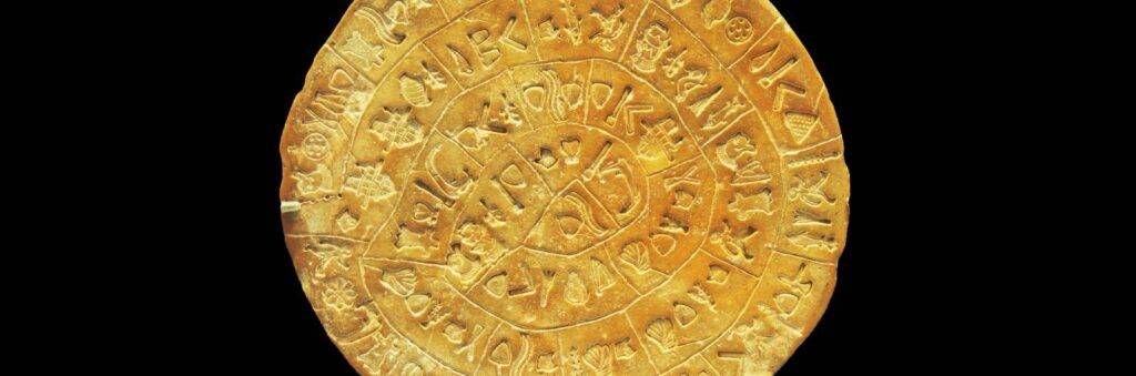
Phaistos Disk. The messenger of the forgotten world
READ MORE

Zvara. About music, dance, Zagori Races and cosmic religion of Greece
READ MORE

The Path of Your Dreams. From Chora Sfakion to Elafonisi Beach
READ MORE